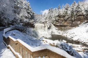

West Virginia’s recreational trails get a Google Maps-like boost.
They may not boast cars and trucks whizzing along graded curves and
sailing across mountains at high speeds. They may not even see the
congestion of a downtown city boulevard at rush hour. But West Virginia’s trails—our hiking, biking, and riding paths of dirt, gravel, and sometimes pavement—are still some of the most trafficked roads in the state. Recently, under the purview of the West Virginia Division of Highways, they’ve been given their very own tech boost into the 21st century. We all use Google maps, or variations of it, when making trips into locations unknown; when those trips are into West Virginia’s wilderness, you can now whip out the new West Virginia Trail Inventory to chart your course in just as much detail.
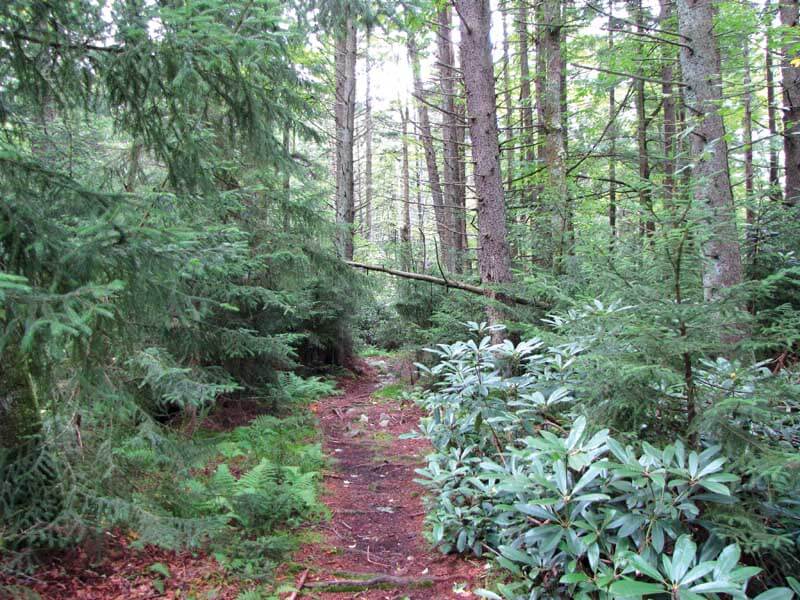
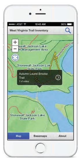
A project years in the making, the West Virginia Trail Inventory is a web-based map that provides overviews of public trails, their start and end points, approved uses, elevations, and managing agencies—all in one place. The trails are searchable by name or, if you’re just curious about what’s nearby, available by location. Click on the Laurel Fork North Trail running through Randolph County, for example, and you’ll find that it’s 9.5 miles long, climbs more than 200 feet in elevation along its length, and is open for
hiking, horseback riding, and back-packing, though it is closed to mountain bikes. The Monongahela National Forest manages the trail, and the forest office in Elkins has more information about its conditions. The map provides links to appropriate organization websites as well as phone numbers. Trail coordinates, map downloads, and a system to report washouts and other trail issues are all available.
The inventory seems simple—obvious, even—but the work that went into it is anything but. Kurt Donaldson, manager of the West Virginia GIS Technical Center in Morgantown that was charged with compiling the trail data and creating the map inventory, says work began as far back as 2010. “Our role was to inventory and collect all the publicly accessible trails in West Virginia,” he says. “Since 2010 we’ve collected more than 5,000 miles of trails.”
The technology is GIS, or geographic information systems. In this case, that meant combining computers and trail geography. “We collected trail lines, trail heads, points of interest, bathrooms, and parking lots. We also collected information about trail stewards and contacts. When you put it all together, it’s called a geodatabase,” Donaldson says.
That task involved a lot of legwork between about 10 West Virginia University students under Donaldson’s watch and a handful of staff members at the Rahall Transportation Institute (RTI) at Marshall University in Huntington. “We divided it up and, initially, the Rahall Transportation Institute focused on southern counties, and WVU focused on northern,” Donaldson says. The groups contacted trail stewards throughout the state, often trail volunteer leaders and state park or national park superintendents, to visit trails and collect and validate data.
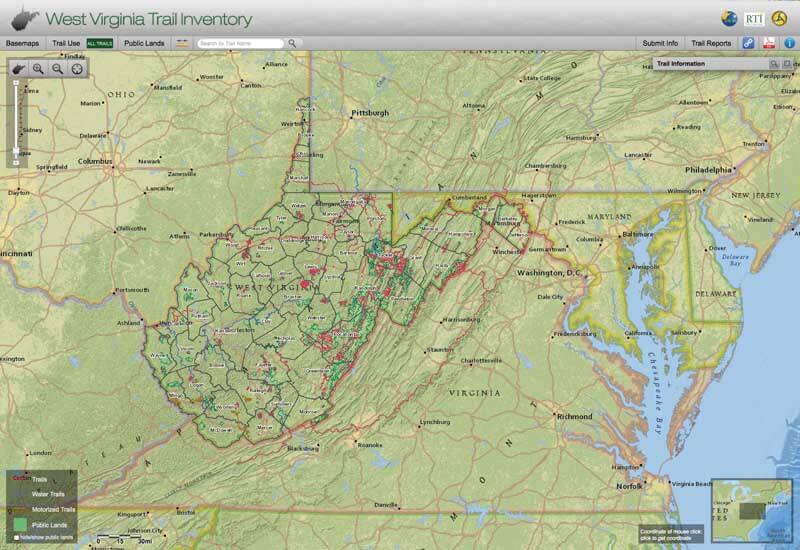
image courtesy of West Virginia GIS Technical Center
Fewer than 20 people total then hiked, biked, and rafted those trails. For the RTI, that journey amounted to about 1,400 miles. “My poor field crew,” jokes Amanda Payne, RTI trail system program manager.

Equipped with Trimble GPS units, a commercial GPS with sub-meter accuracy, the crew went hiking and mountain biking. “That’s the big difference between personal GPS units and commercial GPS units,” Payne says. “Those smaller personal units have up to three- or five-meter accuracy, which means they could be five meters off, and in places like Fayette County that can be a lot.” The field crewmembers are outdoors-types, with positions called trail specialists and duties that take them far and wide across the state’s trails, but this was no leisurely jaunt. “I’m into cycling and I do like hiking, and so does our field crew, but it does test your love for the outdoors,” Payne says. “You’re out there every day hiking miles and miles of trails.” Projects like these have deadlines and, to meet them, crewmembers had certain numbers of miles to hike per day, rain or shine, summer or winter. For longer trails and water trails, though, crewmembers happily mounted their GPS units to bikes and rafts.
“I don’t think people realize how many trails are in the state—all different types, hiking, biking, rail-trails, ATV trails,” Donaldson says. “I didn’t think trails would change that much, but there are always new trails being developed.”
For data junkies, the inventory findings offer some interesting statistics:
- The top five West Virginia counties for miles of trail are Pocahontas, Tucker, Randolph, Logan, and Raleigh. Pocahontas County leads that bunch with more than 320 miles of trail.
- The top five West Virginia counties for number of trails are Tucker, Kanawha, Raleigh, Monongalia, and Logan. Tucker County boasts a little over 200 individual trails.
- The longest trail in the state is the Allegheny Trail, which crosses through Preston, Tucker, Randolph, and Pocahontas counties along 264 miles.
The inventory is more than 90 percent complete, and trails continue to be added as mapping progresses. “We still have five or six counties that we need to do but, for the most part, the initial phase is finished,” Payne says. Of course the project will continue to need maintenance as trails open, close, and evolve. The information is all currently available online, but the GIS tech center is also working on a smartphone application to make all of its information accessible offline, too. “We’ve had a number of states Georgia, Missouri—that have wanted to emulate the West Virginia Trail Inventory,” Donaldson adds. Payne has also been contacted by states out West. “It’s definitely a model other states are starting to use, and it’s a pretty simple model. Mostly what we did was send people out there with GPS units and maps to hike the trails.”
Access the trail map at mapwv.gov/trails
So why is the West Virginia Trail Inventory maintained through the state Division of Highway?
The state trail coordinator is housed within the Department of Transportation’s Division of Highways and the Grant Administration Unit. It’s a legislative position charged with coordinating grant funding for trails programs.
“It was part of the state trail plan to try to properly inventory the trails throughout the state, says Ryan Burns, manager of the Recreational Trails Program. “It’s a form of outreach to let people know where all the trails are in the state and allow them to see the level of difficulty in the trails.”
This story was originally published in the June 2016 issue of Wonderful West Virginia.
written by Katie Griffith